-9- Page: 1 2 3 4 5 6 7 8 9 10 11 12 13
| niagara falls 3 N43°5'5.35", W79°4'34.86" 2010-09-06 | 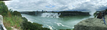
| |
| niagara falls 2 N43°4'41.77", W79°4'42.38" 2010-09-05 | 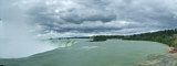
| |
| niagara falls 1 N43°5'21.52", W79°4'36.05" 2010-09-05 | 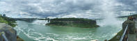
| |
| coventryville old shops 2 N42°19'9.26", W75°33'42.97" 2010-09-05 | 
| |
| coventryville old shops 1 N42°19'9.27", W75°33'42.16" 2010-09-04 | 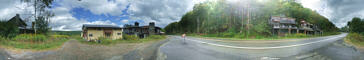
| |
| fleischmanns sunset 1 N42°11'1.57", W74°32'16.65" 2010-09-03 | 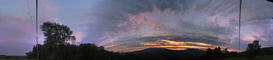
| |
| roxbury mountain sunset 1 N42°18'10.12", W74°38'20.00" 2010-08-28 | 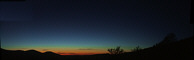
| |
| utsayantha from tower 1 N42°23'54.84", W74°35'23.35" 2010-08-20 | 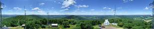
| |
| gunhouse hill dusk 1 N42°24'22.28", W74°42'13.90" 2010-08-19 | 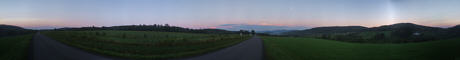
| |
| adirondaks chapel pond 2 N44°8'25.61", W73°44'48.95" 2010-08-19 | 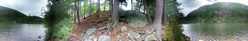
| |
| adirondaks chapel pond 1 N44°8'24.46", W73°44'46.23" 2010-08-19 | 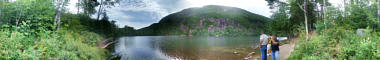
| |
| adirondaks split rock falls 5 N44°7'25.69", W73°39'24.91" 2010-08-19 | 
| |
| adirondaks split rock falls 3 N44°7'25.88", W73°39'25.59" 2010-08-19 | 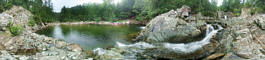
| |
| adirondaks split rock falls 2 N44°7'26.02", W73°39'26.59" 2010-08-18 | 
| |
| adirondaks split rock falls 1 N44°7'26.28", W73°39'27.42" 2010-08-18 | 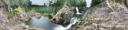
| |
| hobart pavilion 2 N42°22'18.35", E74°40'38.77" 2010-08-10 | 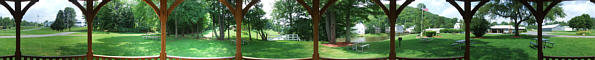
| |
| hobart pavilion 1 N42°22'16.48", W74°40'4.58" 2010-08-10 | 
| |
| hobart historical society 2 N42°22'22.75", W74°40'1.11" 2010-08-10 | 
| |
| hobart historical society 1 N42°22'22.32", W74°40'1.60" 2010-08-10 | 
| |
| blenheim covered bridge 2 N42°28'18.53", W74°26'27.28" 2010-08-08 | 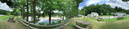
| |
| blenheim covered bridge 1 N42°28'18.36", W74°26'29.21" 2010-08-08 | 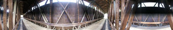
| |
| vromans nose 2 N42°35'21.61", W74°21'19.57" 2010-08-08 | 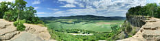
| |
| vromans nose 1 N42°35'26.16", W74°21'32.98" 2010-08-08 | 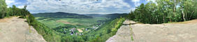
| |
| wide sunset 1 N42°22'9.61", W74°40'14.44" 2010-07-14 | 
| |
| ashokan sky 1 N41°56'57.86", W74°12'25.84" 2010-07-14 | 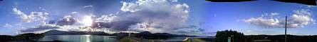
|
-9- Page: 1 2 3 4 5 6 7 8 9 10 11 12 13